Folly for a Fence: Public Footpath from Suburb to City
A folly for a fence-
Public footpaths in England often can be found following the rivers. It's easy to forget that our city was conceived from the need for water. The London river basin is comprised of several rivers, The Thames, with it's tributaries The Rivers Lea, Colne, Crane, and the River Brent, and Right Bank Tributaries including the Rivers Mole, Wandle and the Ravensbourne. Many suburbs of London derive their names from the rivers. People's addresses are water-based place names. This goes on without people being cognizant of how the impact of water has affected their identities and their origins.
What's interesting about a Folly for a Footpath is that the edges of The Basin are where the great reservoirs of water are located and the infrastructure created to contain these artifices are the first evidence of city as one approaches the city from the country side. Invariably, suburbs are formed around these reservoirs. Large residential concentrations of people to feed the industrial 'plant' with humans to work. It is the collision of people and 'plant' that essentially defines the edge of the city. The materials used to construct the infrastructure for these water worlds and how it affects the built environment in the London Basin come together in Folly for a Footpath.
The materials used to manage the water are impervious and utilitarian. The materials used to house the people are impervious and domestic. This is the Metaphor; crossing a fence that is the divide between the domestic, residential suburb and the utilitarian, industrial cityscape occurs as a public footpath stile/ folly located on the fence/ edge between these two worlds and celebrates the edge with cheerful laughter.
What is a public footpath stile?
The most ancient network of travel ways in England are the public footpaths. Landowners are required by ancient law to "refer to your responsibilities as the occupier for the provision and maintenance of gaps, gates and stiles on public rights of way where they cross your land. Remember:
as the landowner you are responsible for maintaining stiles and gates in a safe condition
poorly maintained stiles and gates may leave you liable for any injury sustained by the public attempting to use them
well maintained and clearly waymarked stiles and gates will help prevent people becoming lost and will mean less damage to boundary fences and walls.
Lawful stiles and gates
A stile or gate, although on a public right of way, is not a part of it. Such structures are for the advantage of the landowner, to permit enclosure of the land and to control the movement of livestock, rather than for the benefit of the public.
Therefore, stiles and gates cannot be erected on a public right of way at a landowner's or occupier's discretion. The public's free passage can only be interrupted by such structures certain circumstances:
where a stile or gate traditionally existed in a held boundary for many years and pre-dates recording the right of way
where we can authorise a new stile or gate. Under the Highways Act 1980, section 147, our powers as a county council are limited to authorising stiles and gates only where they are necessary for preventing the ingress or egress of animals on land that is used, or being brought into use, for agriculture or forestry.
note under s147ZA we have to have regard to the needs of people with disabilities when authorising structures
All gaps, gates, kissing gates and stiles should conform with British Standard 5709 where possible
Please note: agriculture includes horticulture, fruit growing, keeping livestock, grazing land, meadow land, market gardens and woodlands.
Existing stiles and gates
Do I have to maintain the stiles and gates on my land?
Yes. The landowner/occupier is responsible for maintaining all such structures on public rights of way in a safe and usable condition (Highways Act 1980, s.146). If you are a tenant the landowner may have passed the practical responsibility to you. If in doubt you should contact your landlord.
Can I replace an existing gate on a public footpath with a stile?
No, as this would normally result in undue inconvenience for the public. Generally the replacement of a gate with a stile will be more inconvenient because people will have to climb over a stile as opposed to opening a gate. If you are experiencing particular problems with people leaving gates open please contact your field officer (see help and advice at the bottom of this page).
Remember: You can replace a normal stile with a gate. Gates give much better access for the public and can be made stockproof.
If I remove a gate or stile and leave a gap instead do I retain the option to restore it at a later date?
Yes, the county council encourages the removal of stiles and gates where they are no longer needed for controlling animals.
Will the county council contribute towards the cost of maintaining existing stiles and gates?
Yes, a landowner is entitled to recover 25 per cent of reasonable costs incurred, but the work must be agreed beforehand. The county council's contribution may be in the form of labour to carry out the work using your materials.
Remember: Before you carry out any work you must contact your field officer (see help and advice at the bottom of this page) to discuss your plans.
Can I lock a gate on a right of way?
In most circumstances a locked gate would be an obstruction on a right of way and therefore cannot be permitted. However, if you are experiencing a particular problem then please contact your field officer (see help and advice at the bottom of this page).
Can I put a new gate or stile next to an existing gate?
You can do so, but it is an additional facility for the public. The existing gate remains on the definitive legal line of the path and must therefore be kept unlocked and available for the public at all times.
To what standard should my gates and stiles be maintained?
All stiles and gates must be maintained in a safe condition, so that they are easy for all users to negotiate, this includes the elderly and the less agile. Please read the 'practical tips' section below. The British Standard for public rights of way gaps, gates and stiles is BS5709:
Remember: There are many local variations which form part of the rural fabric of Oxfordshire. As long as they meet the basic criteria we would not expect them to be replaced with a more modern design. Traditional features, such as Cotswolds stone stiles, should be retained whenever possible.
Is there a minimum width for existing gates on public rights of way?
Yes, on a bridleway it is 5 ft and on a restricted byway or byway open to all traffic (BOAT) it is 10 ft. There are no defined widths for gates or stiles on footpaths, however the public must be able to negotiate them easily."
Historically, people have used public footpath stiles as a rest stop, a place to break from the walk for a bowl of soup and sit on the stile like a piece of furniture.
The London Basin Metaphor, incorporated into a stile would have some of the attributes of a piece of outdoor furniture that would also achieve the objective of assisting a person with negotiating the fence that separated the suburban world of the countryside with the utilitarian world of the city. The suburban side of the fence would be comprised of domestic fabrication while the utilitarian side of the stile would be comprised of durable components found in a sluice gate or a manhole. Each flight, the flight out of the suburban territory and the flight into the utilitarian territory would have to synthesize together as a whole in some way that can easily be understood as a folly, or a totem to the collision of two worlds.
Walking routes
Ware to Waltham Abbey
Monks and Meadows
Distance: 5 miles
A picturesque route from the town centre into the surrounding countryside. Discover the history of the Abbey, the wildlife of the Dragonfly Sanctuary and the beauty of the River Lee Country Park. From Waltham Abbey Gardens, the route heads north through Cornmill Meadows, returning along Waltons Walk.
Dragonfly Discovery Trail
Distance: 2 miles
A circular route that takes in the beauty of Cornmill Meadows and picturesque Tree Park. This trail helps you to discover the many species of dragonfly that inhabit this beautiful sanctuary. From Cornmill Meadows car park, the route travels into the Tree Park, before circling the meadows.[Grebes and Gravel] Grebes and GravelDistance: 2 miles
A circular wildlife and wildflower route exploring Bowyers Water and its natural inhabitants.
Lakes of the River Lee
Distance: 7.5 miles
A scenic circular route with stunning views across the Lee Valley. The route heads north past Bowyers Water then follows the railway to Wharf Road. It turns south down the towpath passing the east side of Seventy Acres Lake and continuing along the Flood Relief Channel.
River Lee Trail
Distance: 4 miles
A circular walk on the Hertfordshire and Essex borders. Discover the greenest and bluest spaces, their fascinating history and wonderful wildlife. The route heads north along the New River, turning east at the north end of Admirals Walk Lake, before returning south from Dobbs Weir along the River Lee Navigation towpath.[Orchid Discovery Trail] Orchid Discovery TrailDistance: 2 miles
A linear route exploring the stunning North Metropolitan and Bowyers Orchid Meadows.
A Royal Reserve
Distance: 4 miles
A circular route through town and country discovering the history and wildlife of the north of the park. The route heads east passing the RSPB Rye Meads Nature Reserve before turning north under the A414. It then turns east into Stanstead Innings, joins the main road through Stanstead Abbotts before returning south along the towpath.
Winged Wonders
Distance: 2 miles
A circular walk taking in a variety of wildlife habitats. Discover a wealth of wildlife including dragonflies, waders and wildfowl. The route travels along the west side of Hooks Marsh Lake and Hall Marsh Scrape, returning along Walton’s Walk.
Water Vole Trail
Distance: 1 mile
A circular wetland route around Silvermeade. Discover our ‘Wind in the Willows’, home of the Lee Valley Water Vole.
Waterbird Discovery Trail
Distance: 4 miles
A linear route linking Cheshunt station to the wetlands of River Lee Country Park. Discover more about the waterbirds of the Lee Valley including their habitats, feeding behaviours and the amazing journeys they have made. From Cheshunt Station the route heads north past Seventy Acres to the Grebe Hide overlooking Holyfield Lake.
Grasshopper Walk
Distance: 0.5 miles
A circular route through Turnershill and Thistly Marshes. Experience the wonderful sights and sounds of crickets and grasshoppers during the summer months. Particularly suitable for disabled people and pushchairs.
Locks and Lakes
Distance: 4 miles
A circular river walk full of rural magic and historical charm. The route travels north along the towpath to Cheshunt before following the river south along Waltons Walk.
Waders and Waterfowl
Distance: 2 miles
A scenic route exploring the southern habitats and spectacles of River Lee Country Park. The route travels north along the Flood Relief Channel, passing the north of Hall Marsh Scrape, returning via the western edge of Bowyers Water.[Weirs to Woods] Weirs to Woods
Rambling Rivers
Distance: 3 miles
A picturesque route visiting the four main rivers that wind their way through River Lee Country Park. The route travels north along the Flood Relief Channel past Seventy Acres Lake before heading south past Cheshunt Lake and Bowyers Water.
Water-Lily Wander
Distance: 2 miles
A circular route around beautiful Bowyers Water. Experience the wonderful views of White and Yellow Water-lilies alongside other water plants such as Yellow Flag Iris in early summer. Particularly suitable for disabled people and pushchairs.
Otter Discovery Trail
Distance: 1¾ miles
A circular route around the glorious Seventy Acres Lake. Discover the habitat and behaviour of one of England’s best loved mammals.
Valley Views
Distance: 8 miles
A scenic circular route with stunning views across the Lee Valley. The route follows the pathway north to the viewpoint at Clayton Hill. It continues onto Meadgate Road before returning south along the towpath to Wharf Road. The route then follows the railway south before turning east at Turnford Brook back across River Lee Country Park.
Wonderful Wet Meadows
Distance: 1.5 miles
A circular river route around Cornmill Meadows. Experience and discover the wealth of wildlife that feed on the wetland meadows.
Faba to Fieldes
Distance: 2 miles
A circular route through tranquil surroundings, with beautiful views, weirs and wildlife. The route travels north past Glen Faba to Fieldes Weir, returning south on the towpath.
Lake and Riverside Trail
Distance: 4 miles
A spectacular wildlife route through the heart of River Lee Country Park. The route travels south, circling Hooks Marsh Lake before heading north on the towpath to Holyfield Weir and returning along the Flood Relief Channel.
Farm and Wetland Trail
Distance: 3 miles
A circular route linking the Lee Valley Park Farms to the wetlands of River Lee Country Park. An ideal route for all ages and abilities throughout the year. The route travels west across the three waterways before turning south around North Metropolitan Pit and returning along the east side of Seventy Acres Lake.
Waltham Abbey to Tottenham
Rockets to Woodland
Distance: 3 miles
A circular valley route discovering the explosive history of Sewardstone Marsh’s wet woodland. The route travels west, following the perimeter of Gunpowder Park down to Sewardstone Marsh, looping around the woodland area before heading north back through the centre of Gunpowder Park.
Marshes and Meadows
Distance: 5 miles
A circular route discovering the rich grasslands and wildflowers of this historical site. The route travels south through Gunpowder Park and Sewardstone Marsh, following Section 18 of the London Loop to Swan and Pike Pool. It continues north through Rammey Marsh to Highbridge Street before turning south back to Gunpowder Park.
Art on the Marshes
Distance: 1.5 miles
A circular route highlighting the community art of Clendish Marsh. The route heads south towards Ferry Lane, turning west at the allotments and circling the perimeter of the marsh.
Gunpowder Woodland Trail
Distance: 1.3 miles
A circular route exploring the wet woodland and wildlife of Gunpowder Park. The route heads west along the high path before turning south through the woodland boardwalk and returning along Sewardstone Road.
Rammey Ramble
Distance: 1 mile
A circular route that explores the Bee Orchids of Rammey Marsh.[Walk on the Wild Side] Walk on the Wild SideDistance: 1.5 miles
A circular route discovering the ‘wilds’ of Tottenham Marshes. The route heads north around the perimeter of Wild Marsh West before crossing the river and returning along the towpath.
Urban Oasis
Distance: 3.5 miles
A figure-of-eight route through Tottenham Marshes discovering the diverse wildlife of this urban jewel. The route loops north around Wild Marsh West and over the river before heading south through Clendish Marsh returning back along the towpath.
Tottenham to River Thames
Nature’s Magic
Distance: 2 Miles
A route to discover a magical secret garden packed with history. The route follows the pathways through the Waterworks and Middlesex Filter Beds Nature Reserves.
Filtering Back in Time
Distance: 5 miles
An intriguing historical circular route exploring the urban and rural diversity of the area. The route heads north, circling Springfield Park before returning south to Hackney Marshes along the Lee Valley Pathway and west through the Middlesex Filter Beds.
Planes and Trains
Distance: 1 mile
A circular wildlife and heritage route around Walthamstow and Leyton Marshes.
Walthamstow Wonders
Distance: 2 miles
A circular route exploring the wildlife and heritage of this spectacular nature reserve. The route heads north through Horseshoe Thicket to Coppermill Fields, returning south along the Lee Valley Pathway and Leyton Marsh.
Three Hidden Gems
Distance: 2.5 miles
This linear route discovers three hidden wonders steeped with history and wildlife. The route heads south on the road to Bow Creek Ecology Park. Following the pathway through and back, the route then continues south, crossing the road towards the river and Trinity Buoy Wharf (off Orchard Place) before doubling back to East India Dock Basin.
Mills and Thrills
Distance: 4 miles
This circular route explores London through time offering a taste of the old and the new. The route follows the paths around Three Mills Island linking to the Greenway and the River Lee returning back to Three Mills.
In England and Wales a public footpath is a path on which the public have a legally protected right to travel on foot. Public footpaths often form a dense network of short paths, offering a choice of routes to many different destinations. It is probable that most footpaths in the countryside are hundreds of years old or more.
Footpaths are shown as dashed green lines on Ordnance Survey 1:25,000 (Explorer) maps, or dashed red lines on 1:50,000 (Landranger) maps.
Ordnance Survey maps carry a disclaimer indicating that, besides those routes which have been added on the basis of local highway authority records, 'the representation on this map of any other road, track or path is no evidence of the existence of a right of way'. The exact wording varies from one map series to another. Official changes to the path network may take some years to appear on published mapping.
Local highways authorities (usually county councils or unitary authorities) are required to maintain the definitive map of all public rights of way in their areas and these can be inspected at council offices. If a path is shown on the definitive map and no subsequent order (e.g. a stopping up) exists then the right of way is conclusive in law. But just because a path is not on that map does not mean that it is not a public path, as the rights may not have been recorded. The Countryside Agency estimated that over 10% of public paths were not yet listed on the definitive map. The Countryside and Rights of Way Act 2000 provides that paths that are not recorded on the definitive map by 2026 and that were in use prior to 1949 will automatically be deemed stopped-up on 1 January 2026.
A public footpath is sometimes waymarked using a yellow arrow on a metal or plastic disc or more informally by coloured paint dots on posts and trees.
The right of access on a public footpath normally only extends to walking (there may be other unrecorded rights as well), so there is usually no right to cycle or ride a horse on a public footpath. However, it is not a criminal offence to do so, unless there is a traffic order or bylaw in place specifically - instead it is a civil wrong to ride abicycle or a horse on a public footpath, and action could be taken by the landowner for trespass or nuisance by the user.[1]
The highway right to use right of way is restricted to passing and re-passing, associated activities, and the taking of 'usual accompanyments'. Bedford Borough Council mentions that walkers may:
take a pram, pushchair or wheelchair, where possibletake a dog as long as on a lead or under close controladmire the view, stop for a rest, have a small picnic on the vergetake a short alternative route to get round an obstruction.
Ordnance Survey Footpaths
Ordnance Survey shows public footpaths on all of its mapping in order to educate people about their right to access any given area of land. If you are planning to explore the countryside on foot then you should be aware of where you can and cannot venture legally.
Although many people think that access is determined by Ordnance Survey, footpaths are established by the owner who in turn informs Ordnance Survey. Local authorities are required to maintain a ‘definitive map’ showing all public footpaths. However, if a footpath doesn’t appear on that map it doesn’t necessarily mean it isn’t a public path.
Normally, the right to access a footpath only extends to walkers, however, it is not illegal to cycle or ride a horse on such a path. It is only unlawful if there is a traffic order or a bylaw in place which states that it is illegal to cycle or horse ride. Landowners can take action against people misusing public footpaths on their land.
Most of the land in Great Britain is owned by someone, be it the local authorities or private landowners but most of the countryside can be accessed safely and legally with the help of Ordnance Survey. Public footpaths are easy to identify when you know what to look for.
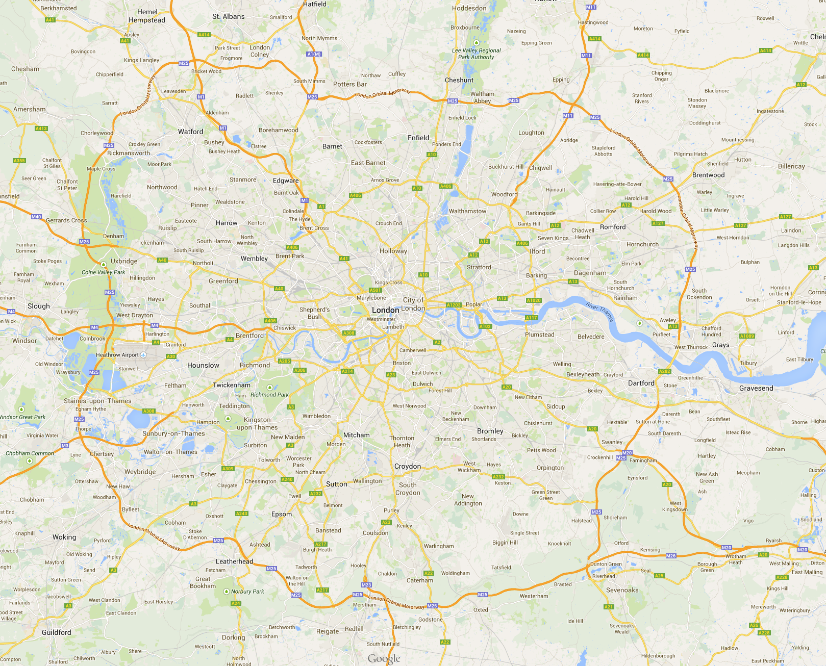
London is a river basin, where rainwater returns to the sea.
The convergence of these rivers just adds water. The more water, the more people that can live there. This phenomenon of the city has a co-dependency- more water, more people, larger reservoirs, larger industries, larger industries, more city, more city, more people need more water. This phenomenon begins to define traffic in the city with canals and major roads following the flow of water.
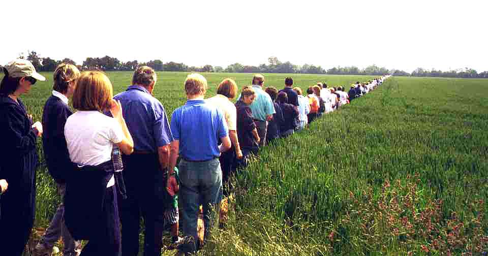
Public Footpaths in England are one of the most fundamental rights of passage that they are enshrined as covenants in ancient county maps. If a public footpath is threatened by development, people go.
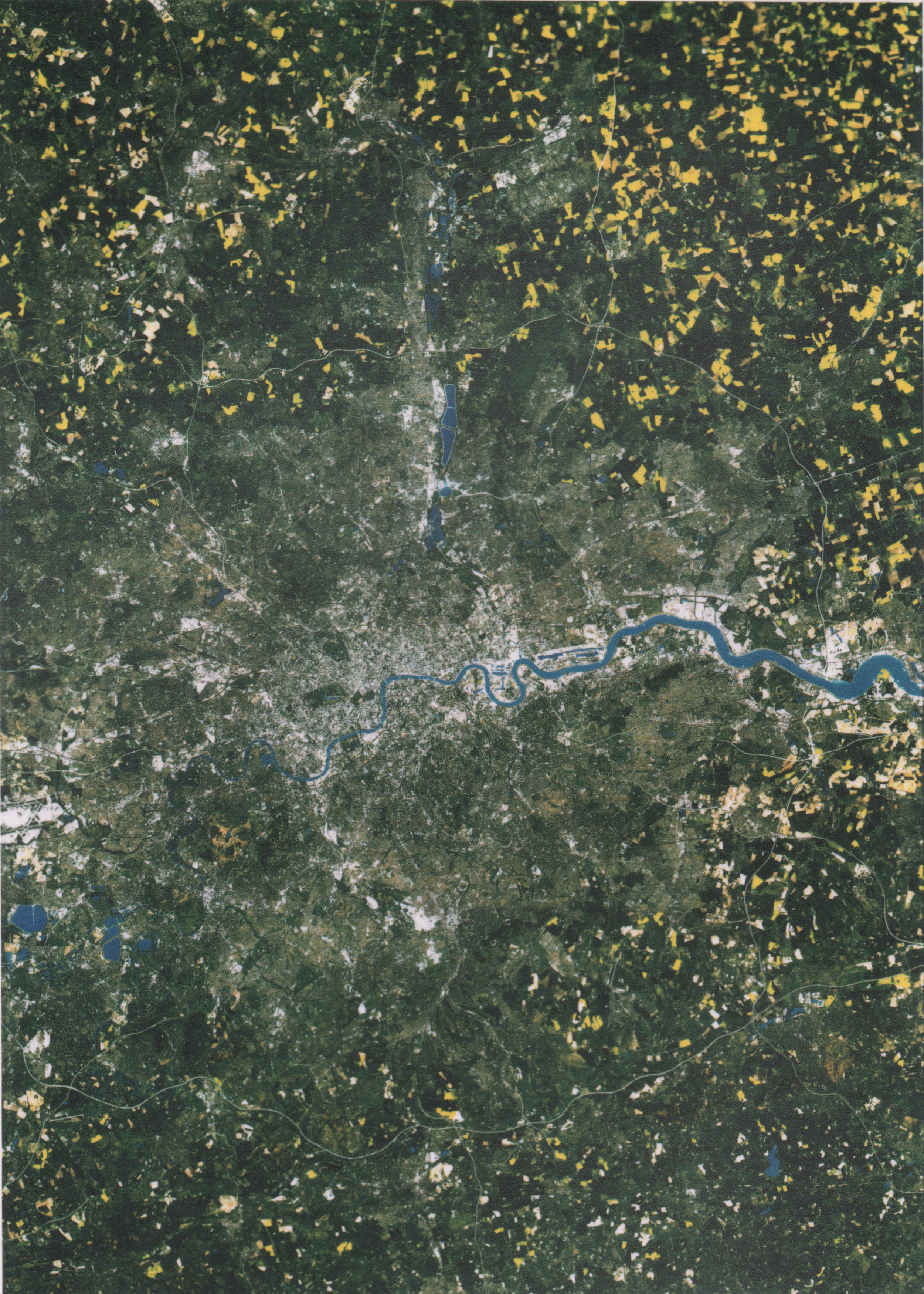
Yellow Oilseed Rape fields bloom in the springtime, all around the City of London. This is the edge of the city.
Public footpaths in England have preeminence over many other land uses. If a land owner has purchased a piece of land that has an established public footpath, then the land owner may not erect an obstruction to that public footpath unless an approved method of allowing a foot traveller to surmount that obstacle is constructed in conjunction with that obstacle. That method of surmounting is call a stile. Stiles are common on public footpaths in England. Public footpaths which once traversed the countryside in ancient times are now enshrined in the urban context as pedestrian only walkways that predated the ancient buildings that now conjoin their boundaries.
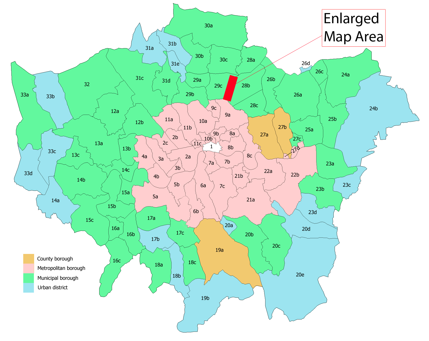
Inner London / Outer London- This is where the edge between suburbia and city is so well defined...
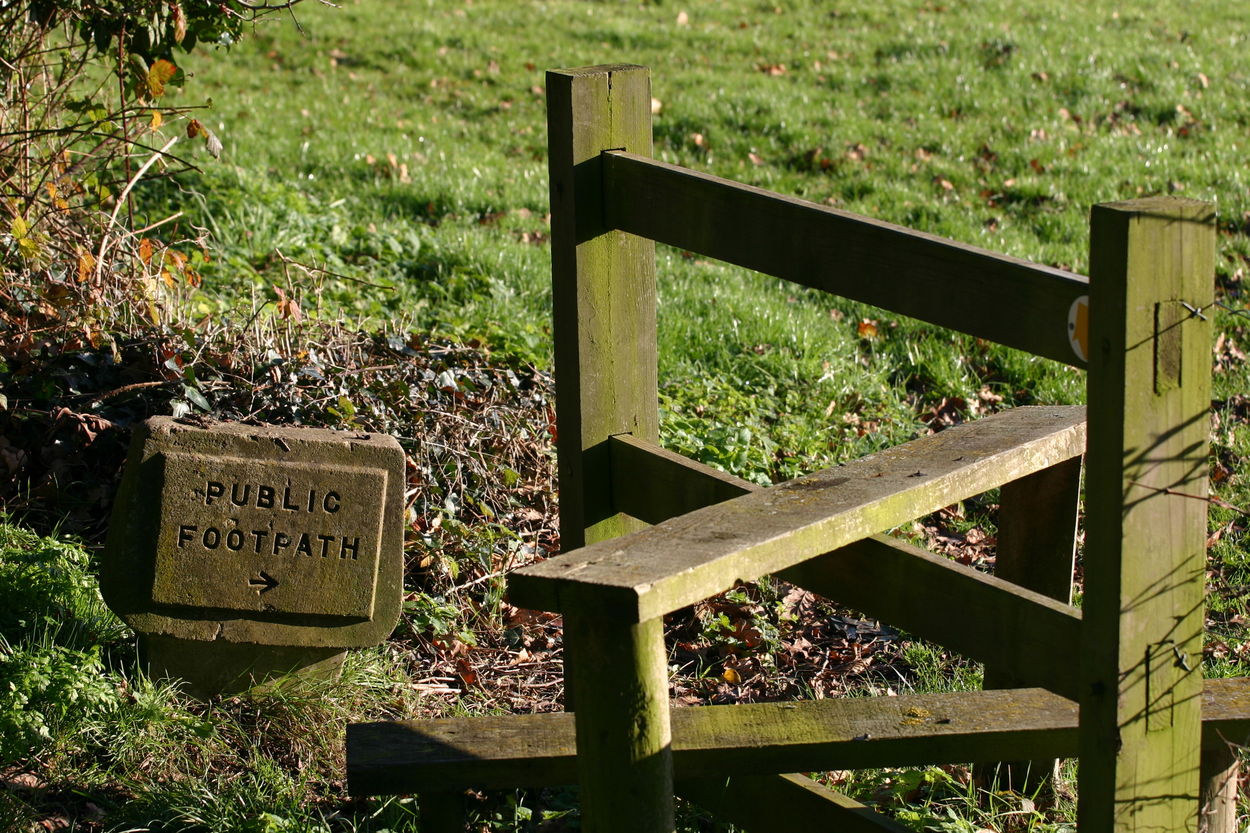
The Stile- A means of passage over a fence lawfully erected for agricultural purposes on a public footpath.
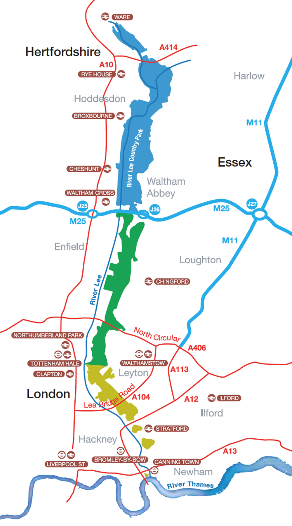
Ancient Public Footpaths from Suburbia to the Inner City East London are well known to the local people who broadcast their existence.
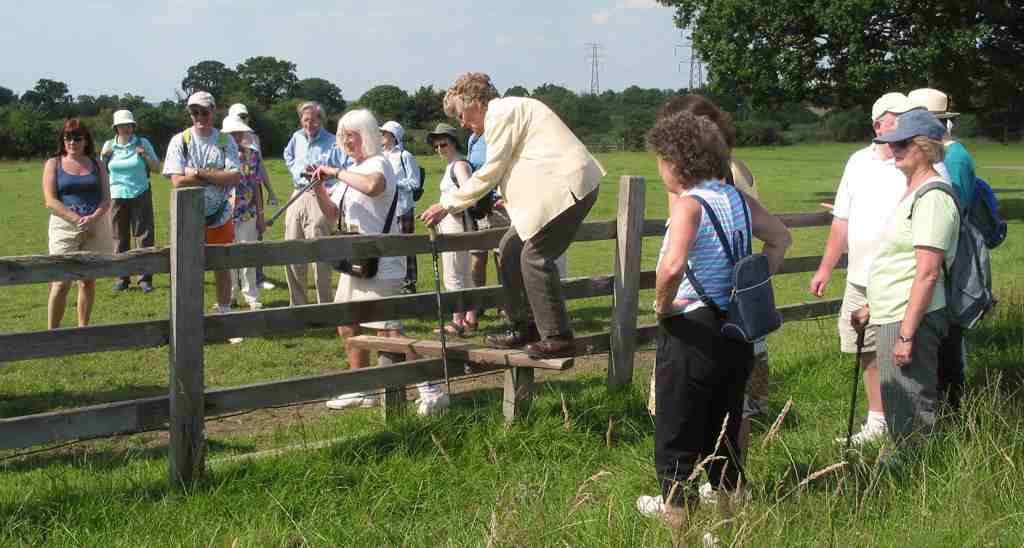
Foot travelers will negotiate with a stile in order to carry on walking along the public footpath.
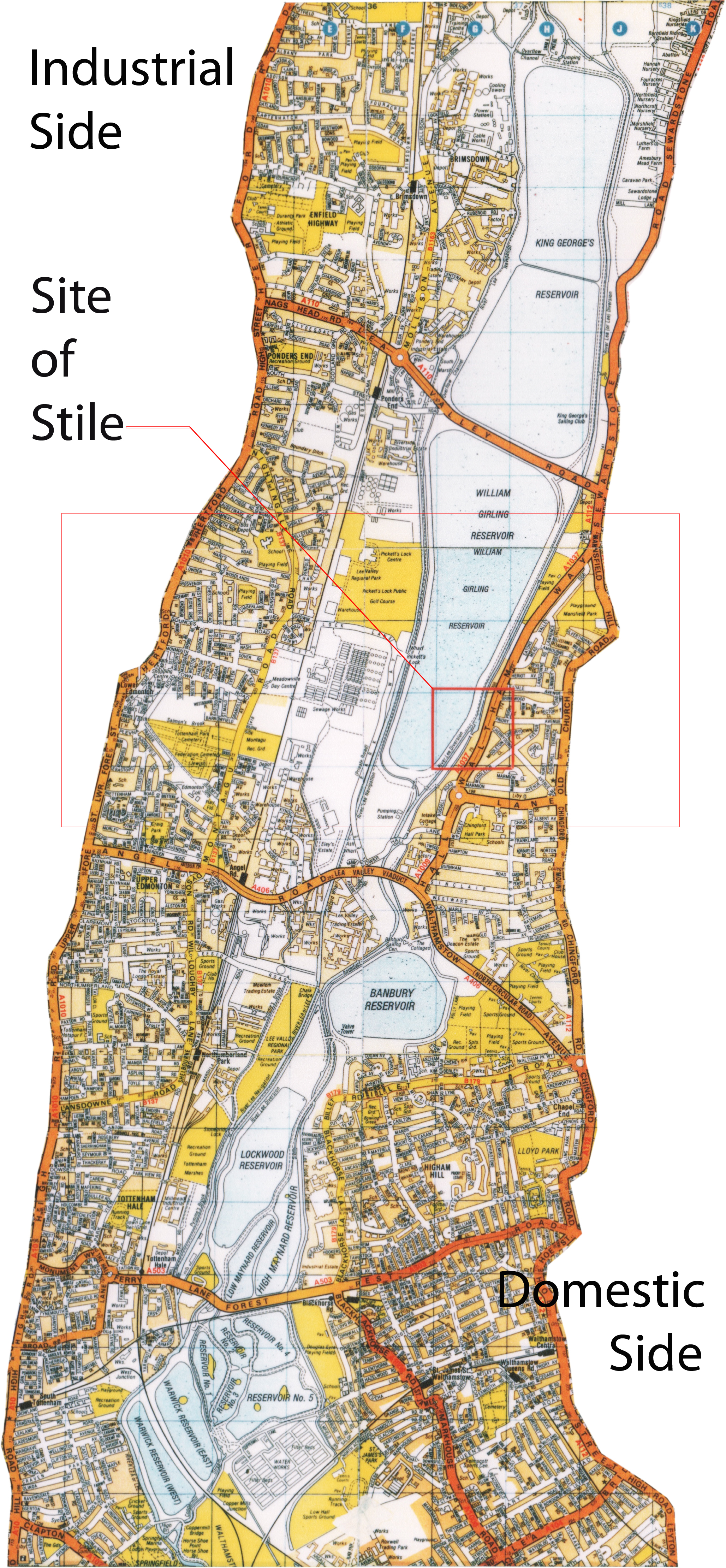
The Lea Valley- This vital water supply for eight million Londoners is also rich in public footpaths due in part to its infrequent intersections with vehicular traffic.
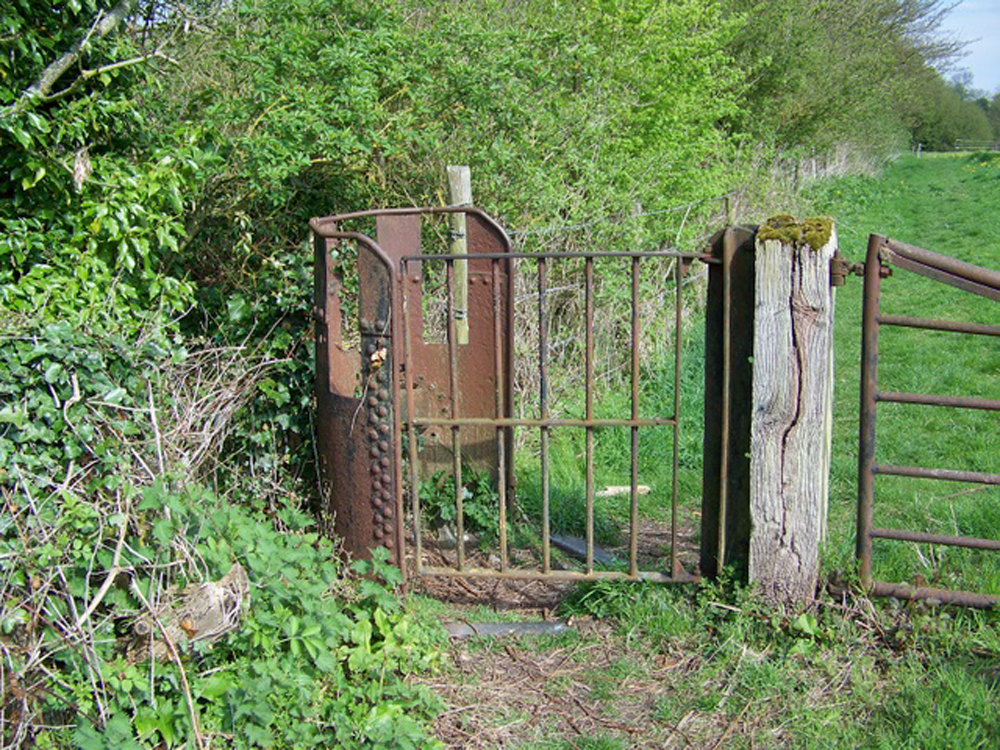
Industrial Era Stile- Here, use of cast iron in the design of a stile is indicative of adjacency with industry and utility. Could we be closing in on the city?

When selecting a site for the London Basin Metaphor, the redirected River Lea becomes a civil engineering marvel that forms a natural foot traveler's pilgrimage.
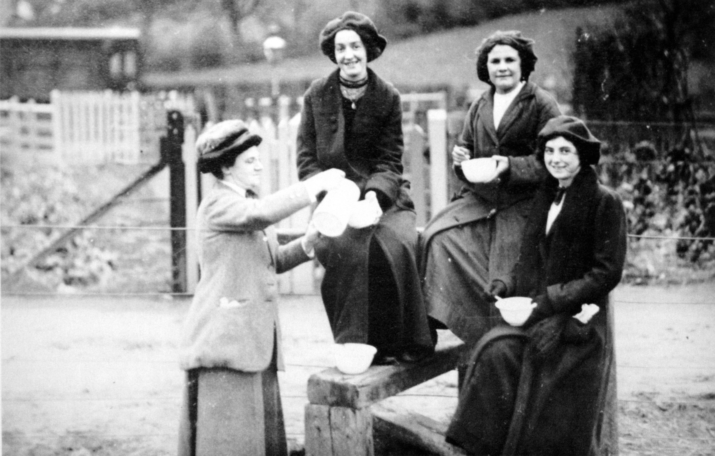
Historically, people have used public footpath stiles as a rest stop, a place to break from the walk for a bowl of soup and sit on the stile like a piece of furniture.

Here, we see the design of a somewhat a-typical stile- one that allows the foot traveller to steady himself with wheel barrel handles.
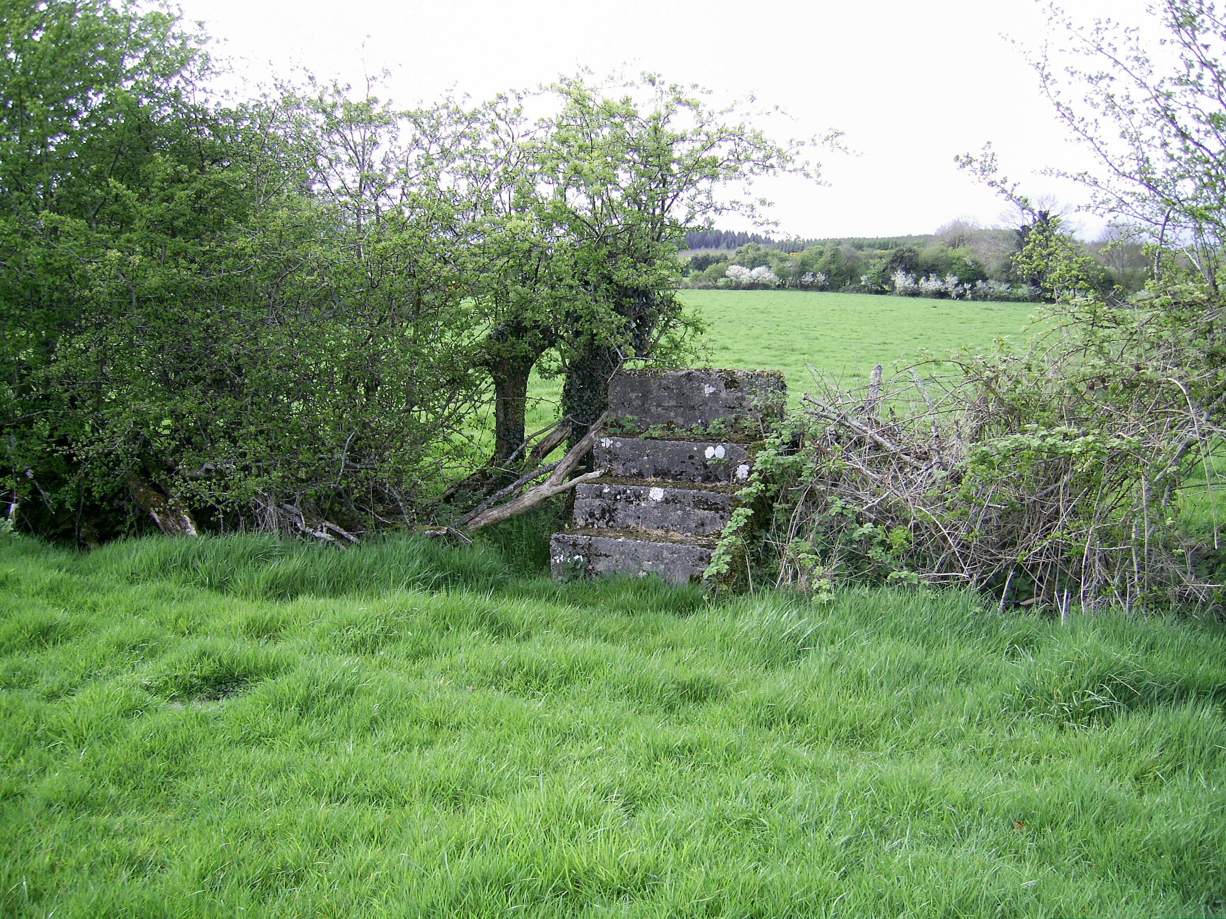
This stile, made of concrete, is made of materials that say little about the territory.
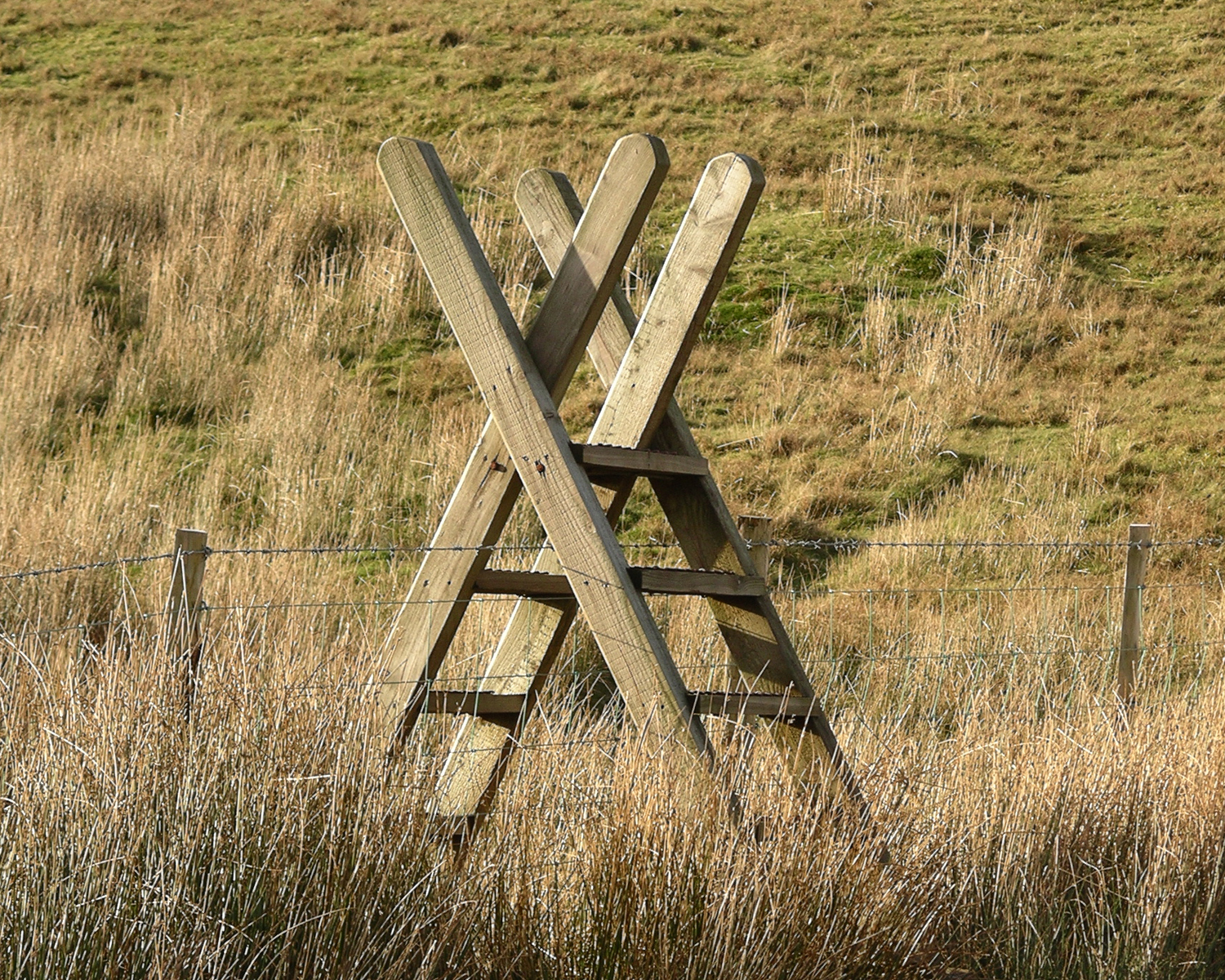
Simple co-operation between two ladders successfully accomplishes the task, and with bracing for the upper body.
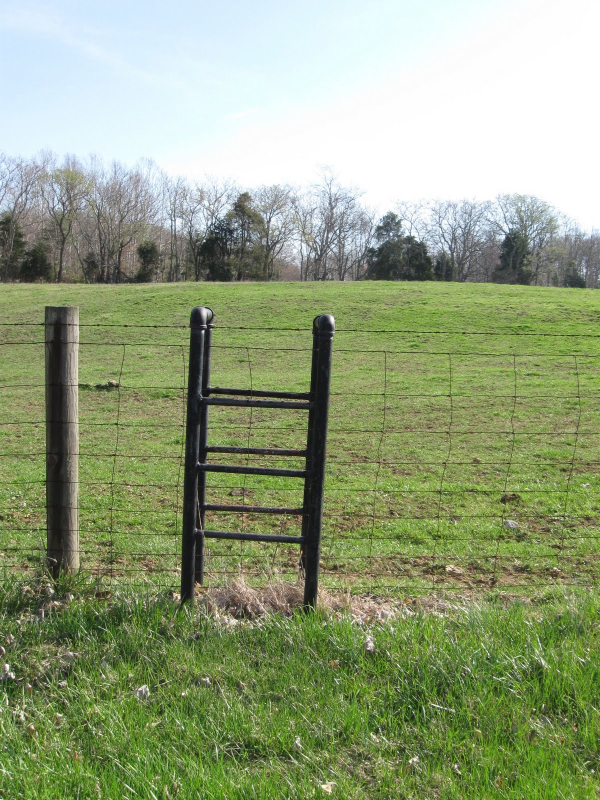
Here, steel plumbing pipe is co-opted into service as a stile for scaling a wire fence.
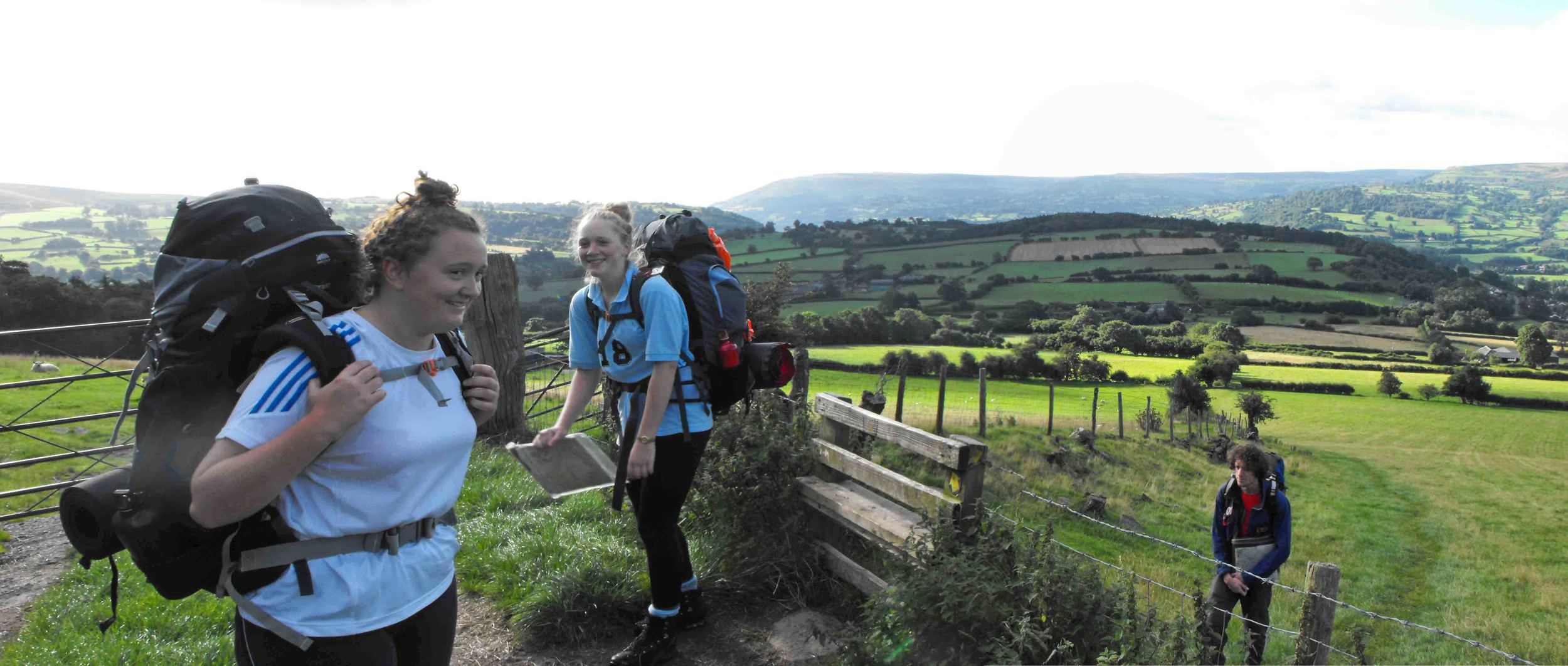
Climbing over a stile with a back pack can be a challenge for the foot traveller determined to cover serious mileage via public footpath.
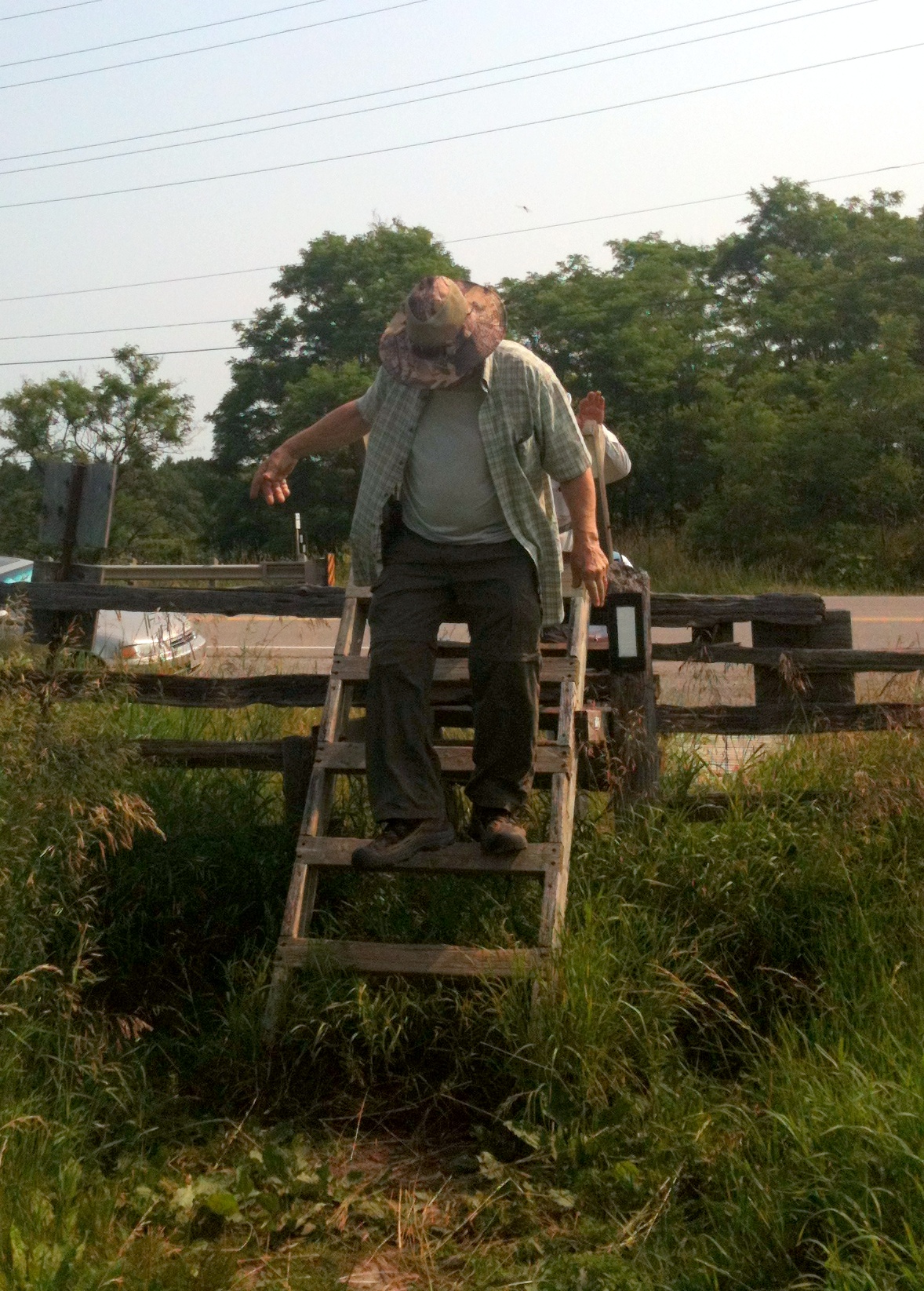
Traversing ladder-like stiles as though they are stairs is inadvisable due to the anatomy of the heel, it's best to descend backwards.
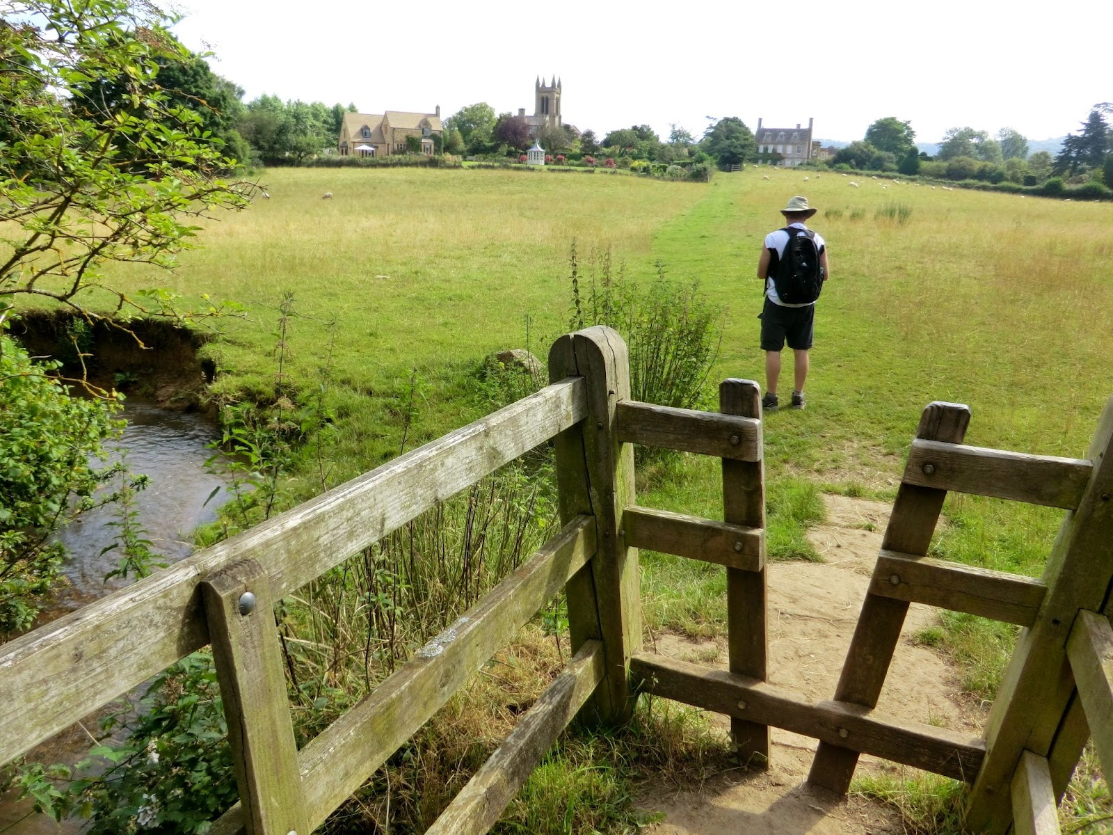
Each and every stile is a threshold into some new stage of travel, some new space, some new territory- a signal of one's movement through the world.
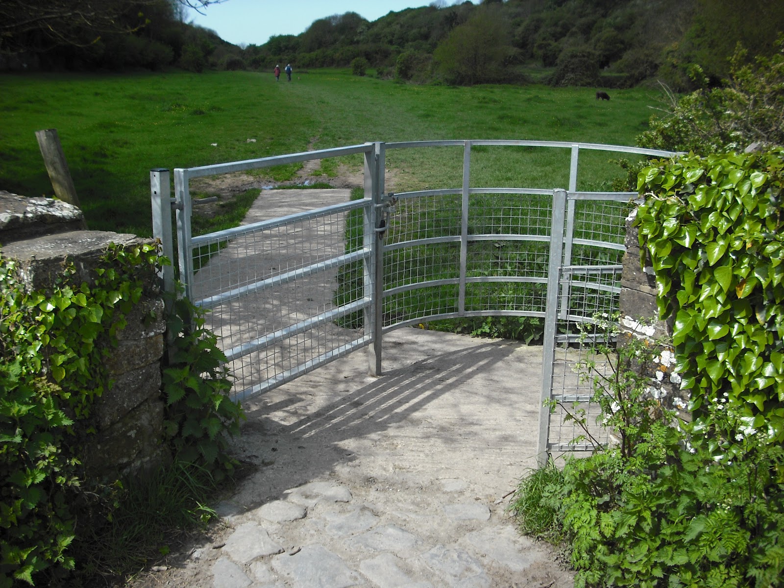
This elegant galvanized pipe stile is paved, and defends the ground against foot traffic and erosion. This type of stile is known as a "kissing gate".
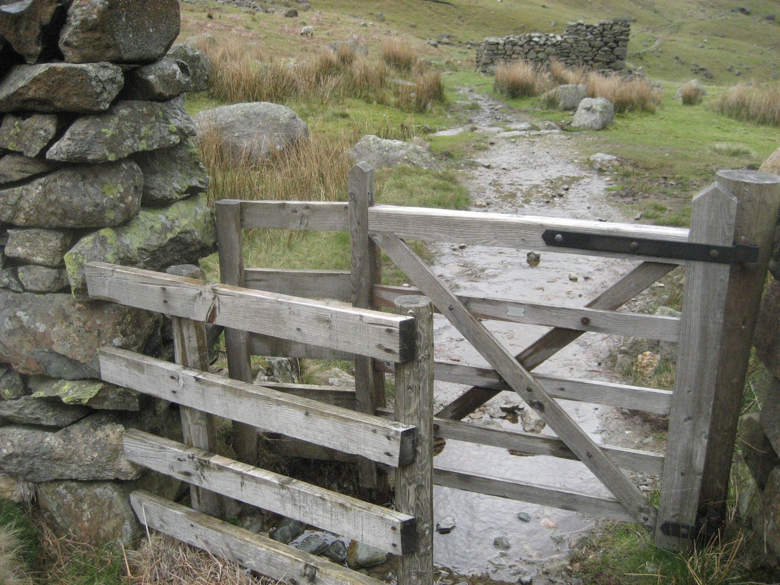
A cow cannot pass through this stile, and that is a comfort to the land owner- and a courtesy for the foot traveller.
